Stitch Plan Tool
The new Stitch Plan tool, located in the Plans tab, enables users to scale, rotate, and move a plan using a reference line from an already correctly scaled plan.
This tool was designed to expedite the process of merging multiple plans for large projects, such as roads, which often consist of several plan files.
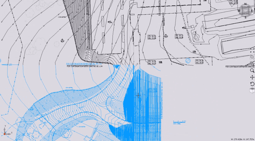
To use the tool, first import and correctly scale a plan. Then, select another plan that needs to be aligned or stitched with the first one. Select the Stitch Plan tool from the Plans tab, draw a reference line on the plan you want to scale, and then draw the same line on the scaled plan, ensuring you start and end at the same points. This will align the second plan to the first. Repeat this process for any additional plans.
An example of a stitched plan using the new Stitch Plan tool
Calculation Engine Improvements
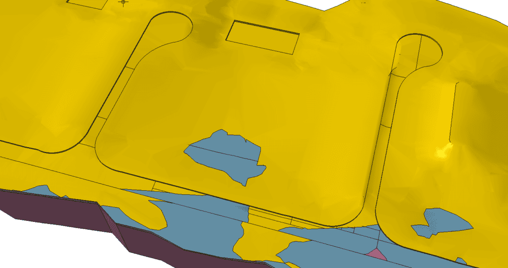
3D View of a project in Version 9 (notice the solid lines along the road)
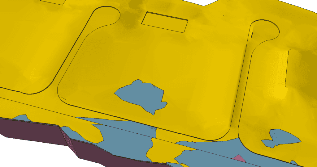
3D View of the same project as above, but in Version 10
A major focus for Version 10 was enhancing calculation capabilities. As projects grow in size and complexity, Brightbox Software recognized the necessity to upgrade the Calculation engine to meet the increasing demands. Users can now expect significantly shorter calculation times and greater robustness for complex projects. Although Brightbox continually work on these improvements, the advancements made between Version 9 and Version 10 are particularly noteworthy.
Additionally, the update has introduced a new checkbox in the calculation settings. The “Proposed Structures Cover Working Area” option can be enabled when your project’s proposed site includes multiple structures. This feature optimizes calculations for such scenarios, further reducing calculation times.
Plan Management Improvements
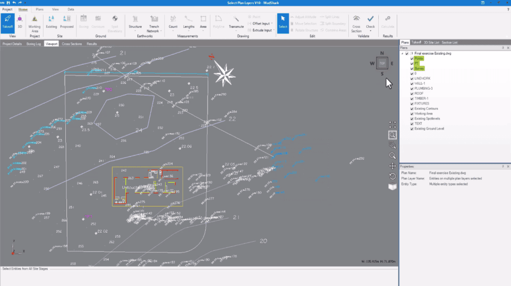
Selecting Plan layers from the viewport now highlights associated layers in the plans tab (see the green highlight on the right)
Locating plan layers in Version 9 was often time consuming. In Version 10, you can simply select one or more entities from the viewport, and all layers containing those entities will be highlighted in the Plans pane. This feature is excellent for quickly isolating important layers and disabling those you don’t need.
And more!
Here are some additional new features and improvements that, while not large enough for their own sections, will significantly enhance the MudShark user experience:
- The ability to transmute plan layers that contain both XREF and regular data.
- Improved DWFX plan reading and layer exploding capabilities.
- Easier boundary selection in cases where multiple boundaries intersect.
- Boundary points are now displayed without selection, which is useful for banking/batter input.
- Performance and stability enhancements for Trench calculations.
- Transmuting points from a TIN mesh is now much faster, with the process reduced from 3 hours in Version 9 to just 3 minutes in Version 10.
As previously mentioned, MudShark 10 is available now for any customer with an active Subscription or Software Assurance agreement.
If this does not include you, and you are interested in updating, email us at: sales@bsssoftware.com and we will arrange a quote.

